

SURVEYING | Expert & accurate.

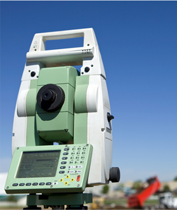
Topographic Survey
Understanding the lay of the land can make or break a development. Accurately defining the contours and spatial features of a property informs every aspect of your build, from utilities, roads and walkways to your buildings, boundaries and landscaping.
Tripp Andrews Surveyors are highly qualified, meticulous and experienced – providing you with key data points, considered recommendations and peace of mind to make the right decisions for your development.
Our expertise is guided by the latest technology for detailed surveying, and we provide traditional hard copy reports and digital DWG formats.
Topographic surveys are perfect for:
- Building design
- Subdivision design
- Roading and infrastructure design
- Stormwater and flood analysis
- Landscape design
- Slope stability assessments
Contact us to conduct a topographic survey.

Setout
Are you about to construct a new building, pipeline, driveway or road? Reduce the risk of building in the wrong location with a setout survey – an up-front, cost-effective way to avoid an expensive mistake.
Tripp Andrews can undertake a setout survey to confirm your construction project is in the right place and in line with the design plans. Get peace of mind from the getgo rather than a headache down the track.
We also offer continuous support throughout the construction phase to ensure the build is on target and can produce setout certifications to satisfy council building inspectors and engineers.
Contact us to conduct a setout survey.

As-Built Surveys
An as-built survey records the exact location and description of your project’s structures or defined features – during and after construction.
Our as-built surveys capture the exact 3D position and description of the required structure or feature, with plans and digital information provided to meet your needs.Our registered surveyors are qualified to certify engineering works and prepare the appropriate certification and documentation for council approval.
Contact us to complete an as-built survey.

Building Certification
Councils require several certifications for key milestones across projects by a qualified surveyor, and no matter what size your project is, keeping track of these milestones can become overwhelming.
Certification checks include:
- Siting (location and extent) of the building/structure
- Finished Floor Level (We can also set the Finished Floor Level before construction)
- Height in relation to Boundary and Maximum Height
- Private Height Restriction Covena
Be confident you comply with the rules and approved design plans with Tripp Andrews from the start, rather than fixing costly mistakes later.
Contact us for building certification and surveying.

Redefinition or Boundary Monumentation Survey
Property boundaries are not always obvious, and assumptions can lead to neighbourly disputes. While fencing or hedging may seemingly make boundary locations obvious, the true legal boundary might not be so cut and dry.
In most cases, the physical boundary pegs may have disappeared over time. The only definitive way to identify actual boundary positions is to have a Cadastral Surveyor carry out a boundary monumentation or redefinition survey on site.
A boundary monumentation survey is supported by a full Cadastral Survey Dataset (CSD) and submitted to Land Information New Zealand (LINZ) as a record of the peg placement. When establishing a new fence, structure or applying to the council for a Resource Consent, the boundaries will be defined legally and satisfy council requirements.
Contact us for accurate boundary surveying.

Easement / Covenant Surveys
Legal easements allow specific rights over a particular piece of land, usually to benefit neighbouring properties, utility providers and councils. The extent of these rights must be defined by a survey before being registered on a legal title.
Easements are generally created for vehicle or pedestrian access (right of way), utility connections, transformers and underground pipelines.
Protective or restrictive covenants.
Legally protect precious native bush or a unique natural habitat with a restrictive or protective covenant registered on your title. Each case is assessed individually, but generally, a site survey is required, including a plan generated to illustrate the extent of the restricted area.
There may be the ability to create a new title by protecting your existing bush or wetlands. Talk to us to find out if this is a possibility for your land.
Both easement and covenant plans are then legally registered on the subject Record of Title at Land Information New Zealand (LINZ) with the assistance of your legal representative.
Contact us to establish covenants or easements on your land.

Rentable Area Survey (BOMA)
Discover the full extent of your commercial building’s income potential with a rentable area survey.
Tripp Andrews can complete an accurate survey of commercial offices, retail and industrial premises to determine the exact rentable area according to the PCNZ/PINZ Guidelines.
Contact us for more information.

Limited Title Surveys
Upgrade to a guaranteed title with precise, detailed surveying.
Tripp Andrews can help lift limitations on your land by detailing a precise outline of your legal boundaries.
Titles described as ’limited as to parcels’ mean your legal boundaries have never been adequately defined, and typically, a complete property survey is required to obtain a guaranteed title.
To define the boundary location, documented evidence, long-standing occupation along the boundary and sometimes oral evidence from long-standing occupants are considered and used to determine the legal boundaries position, which is then illustrated on a new survey plan.
This plan will need to be approved by Land Information New Zealand (LINZ) before any title limitations are lifted and the title upgraded. An important step in this process is to give notice or obtain informed consent from all adjoining property owners, this is a legal requirement under the Land Transfer Act 1952.
Tripp Andrews’ highly qualified surveyors can take you through the process step by step for a fresh set of detailed, accurate legal boundaries.
Contact us to establish a guaranteed title on your property.

Monitoring
Monitoring surveys include meticulous measurements to detect any ground or structure movement during construction or a set timeframe.
Tripp Andrews uses high precision instruments and methodology to detect minute movements or deformation in structures and landforms. Our specialist team can establish monitoring regimes for the total duration of any project.
Contact us to set up your monitoring programme.


